Cities do not happen just anywhere. Geography is key, but it is more than that. Even social and political factors have a lot to do. For instance, it is unlikely that two large cities will end up being too close. Somehow people in the middle will gravitate to either one and leave a gap in the middle.
This post is not about cities but rather about everything that is around them. As usual my goal was to have an algorithm that required little or no human input but still produce believable results. I saw that modeling some form of historic development was the simplest way. This is how it works:
The first step is to identify suitable locations for a new settlement. Obviously the slope of the terrain had a lot to do. Both valleys and mesas make for nice locations, so I just placed points where the derivative of the terrain height was close to zero. I also made sure these points would not end up being too close from one another. The following screenshot shows the results:

The slope intensity is shown in red, the settlement points appear as green dots.
The people (or smart things) in each settlement would naturally expand. That is the second step. They expand as much as possible considering the geography and most important, the expansion of neighboring settlements.
This results in something close to a Voronoi graph:
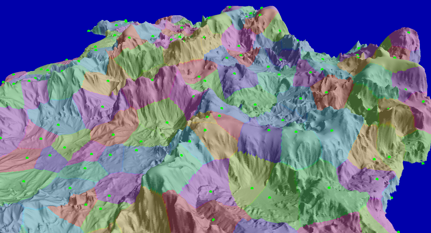
Each colored patch shows the area of a different settlement.
The next step is conquest. Settlements conquer their neighbors. For any two neighboring settlements the odds of a conquest is computed. This depends on how much of a border they share, how steep the terrain is at the border. And there is also a cultural element. Each settlement has a culture value, which mainly comes from bio-geological factors. For instance a settlement that covers mostly fertile land will have trouble conquering a settlement that is mostly on desertic terrain.
When two settlements merge, a country appears. Countries are allowed to grow in this phase, but only up to certain point. As a country grows it becomes less aggressive, nearby settlements may be snatched first by a more motivated smaller country.
The following image shows a newly formed set of countries:

As you can see the original settlement lines still persist, but they became sub-divisions inside a country: provinces, states, counties, any way you may call it.
Each country needs a capital. That is the next step. A capital usually should be as far from neighboring countries as possible, but as close to all other provinces as possible too. It is a delicate balance, and it can be tweaked towards either extreme. I picked a balance that made sense to me:

Here the province containing the capital appears highlighted and its location circled in red.
The last step is to create the main road system. Neighboring cities should be connected, but not every time. The cost of building roads in steep terrain had to be factored. Also, existing roads should be leveraged instead of building new ones. And last, roads should avoid crossing country lines unless absolutely necessary.
I used A* path-finding to bring all these factors together, here you can see the results:

Note that not every province is connected to its neighbor. This usually happens when mountains make a new road too expensive and it is better to just go around the mountains.
So far I am happy with the results. The political divisions match the landscape and terrain types. The roads make sense, but also leave place for exploration.
The next phase is to break down each province and build a large city starting from each green dot. I'm already working on this and it is quite interesting. As soon as I have some results I'll post about it.
